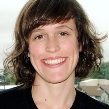
Woods Seminar | Near-Surface Hydrology, Land Cover, and Spatiotemporal Variation in Subsidence Across California’s Central Valley | Morgan Levy, UCSD
Event Details:
Location
Y2E2 Building, Room 299
United States

Join us for a Woods Seminar with Morgan Levy, University of California, San Diego.
Abstract
The sinking of California's southern Central Valley has long been linked at large scales to groundwater overdraft associated with irrigated agriculture. Recent novel high-resolution vertical land surface displacement measurements (Global Positioning System enhanced interferometric synthetic aperture radar, or GInSAR) show that land subsidence and uplift are more heterogeneous across time and space than previously documented. Here we link these displacement measurements to land cover and weather patterns to show that local seasonal variation in potential vegetation water demand drives displacement.
We find that land surface displacement direction, magnitude, and seasonality between 2015 and 2017 vary by land cover across the region. The mean rate of displacement over native rain-fed vegetation ranges from -4.9 ± 0.1 to -4.1 ± 0.1 mm/year in dry and wet years, respectively, and is in phase with water demand (i.e., increased water demand corresponds to uplift). In agricultural areas, subsidence is greater and out of phase with water demand (i.e., increased water demand corresponds to subsidence). The mean rate of displacement ranges from -31.0 ± 0.4 (dry) to -11.2 ± 0.2 (wet) mm/year for fruit and nut crops, and -128.2 ± 1.7 (dry) to -42.5 ± 0.5 (wet) mm/year for field crops. We leverage the large change in surface water availability at the end of the drought in 2016, spatial variation in land cover and water demand, and limited available groundwater withdrawal information to provide a first snapshot of spatially explicit groundwater - subsidence dynamics, and estimates of groundwater withdrawals implied by land surface displacement across different land cover classes.
These methods have the potential to be applied widely for groundwater monitoring at policy-relevant spatial and temporal scales. Beyond the capacity of our approach to support detection of groundwater overdraft, our analysis has revealed subsurface basin boundaries and flow patterns that have direct implications for successful implementation of California’s Sustainable Groundwater Management Act (SGMA).
Morgan Levy’s research focuses on hydrology and water resources; land use and climate change impacts to human health and the environment; human-environmental system dynamics; and environmental data science. Levy’s background includes training in: physical hydrology and eco-hydrology; environmental and earth system science; and applied statistics, including causal empirical methods and spatiotemporal data analysis and modeling.
Morgan is currently a postdoctoral researcher in the School of Global Policy and Strategy at the University of California (UC), San Diego. She holds a Ph.D. (Dec. 2016) and M.S. (2012) in Energy and Resources, and a M.A. in Statistics (2013) from UC Berkeley.
